Sealand, Flintshire
| Sealand | |
| Flintshire | |
|---|---|
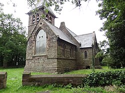
 St Bartholomew's Church, Sealand | |
| Location | |
| Grid reference: | SJ352688 |
| Location: | 53°12’43"N, 2°58’12"W |
| Data | |
| Population: | 2,946 (2011) |
| Post town: | Deeside |
| Postcode: | CH5 |
| Dialling code: | 01244 |
| Local Government | |
| Council: | Flintshire |
| Parliamentary constituency: |
Alyn and Deeside |

Sealand is a parish in Flintshire, on the edge of the Wirral peninsula. It forms part of the Deeside conurbation to the west of the city of Chester. At the 2001 Census, it had a population of 2,746 (1,342 males, 1,404 females),[1] increasing to 2,946 at the 2011 census.[2]
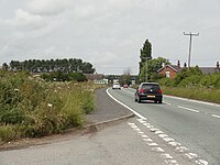
Sealand is on flat land formed by land reclamation of part of the head of the estuary of the River Dee which had become heavily silted-up. It is on the A548 road, near the Chester dormitory communities of Blacon and Saughall.
The Dee flowed to the sea forming the county border between Flintshire and Cheshire, until in the 18th century it was diverted into its present channelized course (entirely in Flintshire) to try to improve ship access from the sea to Chester. That led to extensive land reclamation in the head of the Dee estuary. The River Dee Company (1741-1902) had a right to reclaim the marshes and build embankments following the re-alignment of the Dee.[3]
Timeline
- 1732: Nathaniel Kinderley proposed the scheme.[4]
- 1735-1736: Nathaniel Kinderley & Company cut the new Dee channel from Chester to Golftyn.
- 1737: The new Dee channel was opened for shipping.
- 1740: Kinderley's company became known as the River Dee Company.
- 1753: First polder made: (the land where now are the) Shooting School, Sealand Manor, Garden City, about as far as Hawarden Bridge.
- 1754: Polder made: Ferry Lane Industrial Estate, Thornleigh Park, Sealand Nursery, Deeside House.
- 1768: Polder made: Bank Farm, Birchenfields Farm.
- 1790: Polder made: Yewtree Farm, Church Farm, Sealand village, Waterloo Farm,[5] Willow Farm.
- 1826: Polder made: Old Marsh Farm, rest of low land east of where the A550 road is now.
- 1857: Polder made: where the Deeside Industrial Park is now. (In the 20th century this area was raised 8 feet by sand pumping.[6])
- 1861: The thousands of acres of reclaimed marshlands around Sealand and Saltney were raising £8000 in annual rent.
- 1865-1867: St Bartholomew's Church was built.
- About 1880: West of the Dee, a polder including Beeches Farm (a little north of Hawarden Airport) was made.
- 1892: Polder made: the Shotton steelworks.
- Boundaries of these polders show as old dikes across the farmland.
Airfield
RAF Sealand was originally a civilian airfield and was taken over by the military in 1916 for training. No. 30 Maintenance unit was formed there in 1939. In 1951 the station was taken over by the United States Air Force, and then handed back to the RAF in 1957.
As a result of defence cuts announced in 2004, RAF Sealand was closed in April 2006.
In popular culture
Orchestral Manoeuvres in the Dark (OMD), the globally successful new wave act from Wirral, recorded the song "Sealand" for their seminal 1981 album, Architecture & Morality.
References
- ↑ 2001 Census: Sealand, Office for National Statistics, http://neighbourhood.statistics.gov.uk/dissemination/LeadTableView.do?a=3&b=801000&c=sealand&d=16&e=15&g=414768&i=1001x1003x1004&m=0&r=1&s=1212108182056&enc=1&dsFamilyId=779, retrieved 30 May 2008
- ↑ "Community/Ward population 2011". http://www.ukcensusdata.com/sealand-w05000230#sthash.J14A4Phf.dpbs. Retrieved 26 May 2015.
- ↑ http://www.britishlistedbuildings.co.uk/wa-85248-old-marsh-farm-sealand
- ↑ http://www.angelfire.com/fl/shotton/history5.html
- ↑ The Battle of Waterloo was on 18 June 1815: the farm would have been named some time after that.
- ↑ http://www.tacp.uk.com/projects/landscape/land_rec/index.html
Outdide links
| ("Wikimedia Commons" has material about Deeside Sealand, Flintshire) |
- Photos of Sealand and surrounding area on geograph.org.uk
- Google Earth view of Sealand
- http://www.genuki.org.uk/big/wal/FLN/Hawarden/Sealand/
- http://www.visionofbritain.org.uk/place/8807
- http://www.angelfire.com/fl/shotton/history5.html, History of Shotton, including a map showing dates when land areas in the Sealand area were reclaimed.
- http://www.saughall.gov.uk/?page_id=821, History of Saughall and Shotwick Park, including how the Sealand land reclamation affected Saughall.
