Kilmadock
| Kilmadock Gaelic: Cille Mo Dog | |
| Perthshire | |
|---|---|
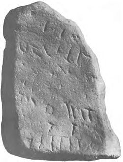
 Inscription stone at Kilmadock | |
| Location | |
| Location: | 56°11’20"N, 4°3’40"W |
| Data | |
| Post town: | Doune |
| Postcode: | FK16 |
| Dialling code: | 01786 |
| Local Government | |
| Council: | Stirling |
Kilmadock is a parish in southern Perthshire close to the border with Stirlingshire. It contains the settlements of Doune, Deanston, Buchany, Drumvaich, and Delvorich. The parish is named after Saint Cadoc. Its length is ten miles, its breadth from two to eight miles, with an area of 24,521 acres.
The ancient parish extends as far south as the River Forth, which also forms the county boundary, splitting the parish of Kincardine in two. The civil parish however has ceded its southern bounds so that Kincardine can be united. The River Teith runs east-south-eastward through the centre. A flat tract of considerable breadth lies along the Forth Valley, flanked on each side by a hill-ridge. The valley is traversed by the Teith, and an upland tract, part of the Braes of Doune, ascends to the summit of Uamh Mhòr on the northern boundary.[1]
References
- ↑ "Uamh Mhor (or Uamvar)As described in John Bartholomew's Gazetteer of the British Isles". John Bartholomew, Gazetteer of the British Isles (1887. http://www.visionofbritain.org.uk/descriptions/entry_page.jsp;jsessionid=A1FF37BBC18007430F74326C22115825?text_id=1805660&word=NULL. Retrieved 2013-03-04.
This Perthshire article is a stub: help to improve Wikishire by building it up.