Kirkmichael, Perthshire
| Kirkmichael | |
| Perthshire | |
|---|---|
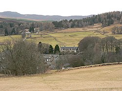
 Kirkmichael seen from the north-east | |
| Location | |
| Location: | 56°43’31"N, 3°31’12"W |
| Data | |
| Post town: | Blairgowrie |
| Postcode: | PH10 |
| Dialling code: | 01250 |
| Local Government | |
| Council: | Perth & Kinross |
Kirkmichael is a village and parish located in north-eastern Perthshire. The village is 13 miles north-west of Blairgowrie and 12 miles north-east of Pitlochry. The parish encompasses Spittal of Glenshee and extends to the borders with Aberdeenshire and Angus.
The name Kirkmichael means "The Church of St Michael"; the Gaelic name is Cill Mhìcheil. The village dates back to the first millennium.
The Village
The village is split into two by the River Ardle. On the north side is the A924 Main Street with the church, Session House community centre, Kirkmichael Hotel, shop, post office, garage and traditional properties dating from the late 19th century. On the south side are the Primary School, Bannerfield, the fire station, Williamston, the village hall, the disused Free Kirk, Sillerburn Road, Whitefield View, the cemetery, Balnald, Balnakilly and the Pinetrees Hotel on the road to Glen Derby. Approximately one third of the houses in the village are holiday or second homes. Permanent population is approx 150.
The original village known as Williamston sits above the school on the original highway from Blairgowrie to Blair Atholl which entered the village past the Hall and Old Kirk and exited by the road to Balnakilly. This now forms part of the Cateran Trail long distance walk.