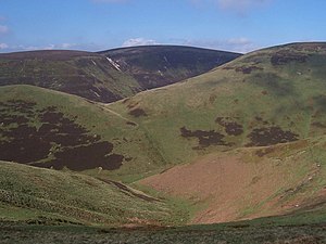
Beefstand Hill
| Beefstand Hill | |||
| Northumberland, Roxburghshire | |||
|---|---|---|---|
 Beefstand Hill from The Street | |||
| Range: | Cheviot Hills | ||
| Summit: | 1,844 feet NT821143 55°25’20"N, 2°16’55"W | ||
Beefstand Hill is a hill amongst the Cheviot Hills, on the ridge dividing Northumberland to the south from Roxburghshire to the north.
The Pennine Way runs over the top of the hill along the county boundary ridge; the summit is one of the main high points on the path along the ridge, west of Windy Gyle
