Lochcraig Head
| Lochcraig Head | |||
| Peeblesshire | |||
|---|---|---|---|
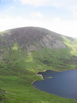
 Lochcraig Head from the south, with Loch Skeen | |||
| Range: | Moffat Hills | ||
| Summit: | 2,628 feet NT158153 55°25’29"N, 3°19’52"W | ||
Lochcraig Head is a hill of 2,628 feet in the Moffat Hills. Its summit is just inside Peeblesshire, but the boundary of Dumfriesshire, at that county's very northernmost point, runs over the southern slope of the mountain. The boundary is generally marked by the watershed between the north-flowing and south-flowing streams.
The southern flank of Lochcriaig Head is marked with a tall, steep scree slope, and beneath this slope (in Dumfriesshire) is Loch Skeen, the source of the stream producing the famous Grey Mare's Tail waterfall just a little to the south.