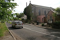
Howgate, Midlothian
| Howgate | |
| Midlothian | |
|---|---|
 Howgate | |
| Location | |
| Grid reference: | NT248581 |
| Location: | 55°48’37"N, 3°12’4"W |
| Data | |
| Postcode: | EH26 |
| Local Government | |
Howgate is a hamlet in Midlothian, to the south of Penicuik. The village stands on the A6094 from Dalkeith, just north of the Peeblesshire border (at the junction at Leadburn).
This Midlothian article is a stub: help to improve Wikishire by building it up.