St Gennys
| St Gennys Cornish: S. Gwynnas | |
| Cornwall | |
|---|---|
 St Gennys Parish Church | |
| Location | |
| Location: | 50°44’38"N, 4°37’26"W |
| Data | |
| Local Government | |
| Council: | Cornwall |
St Gennys is hamlet and a coastal parish in north Cornwall.
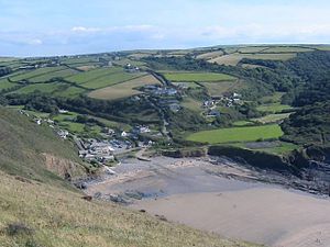
The hamlet of St Gennys is about seven miles southwest of Bude, on high ground half a mile north of the coastal village of Crackington Haven, which is the major village in the parish. The only other villages of any size in the parish are Middle Crackington and Higher Crackington, both of which are southeast of Crackington Haven (half a mile and one mile distant respectively).
The parish population was 873 in the 2011 census.
Several places in the parish are mentioned in the Domesday Book including Crackington (as Crachemua), Dizzard (as Disart) and St Gennys itself (as Sainguinas or Sanwinas)[1]
About the parish


Away from the coast, St Gennys parish is entirely rural. It is bordered to the north by Poundstock parish, to the east by Jacobstow parish, to the south by Otterham and St Juliot parishes.[2] To the west, St Gennys is bounded by the Atlantic coast where Cornwall's highest cliff (appropriately named 'High Cliff') rises 735 feet above the rocky foreshore.
Cambeak is a prominent headland and the cliffs at [[the Strangles] are a National Trust property. In one year in the 1820s it is believed 23 ships were wrecked on this part of the coast.[3]
St Gennys lies within the Cornwall Area of Outstanding Natural Beauty (AONB), as indeed is almost a third of the county.
History
The manor of St Gennys was recorded in the Domesday Book (1086) when it was one of several manors held by Jovin from Robert, Count of Mortain; before 1066 it had been held by Gytha who also held Poundstock. There was half a hide of land and land for 10 ploughs. There were 3 ploughs, 3 serfs, 2 villeins, 8 smallholders, 40 acres of pasture, 7 cattle, 40 sheep and 6 goats. The value of the manor was £1 sterling.[4]
Parish church
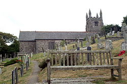
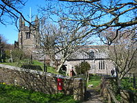
The parish church stands on a sloping site in St Gennys hamlet at SX148971. It is dedicated to Genesius of Arles. The building is partly Norman with a short one-stage tower topped by a pyramidal roof. The tower houses a ring of four bells. The church was restored in 1871.[1] The arcades of the aisles are partly in granite and partly in Polyphant stone.
Outside links
| ("Wikimedia Commons" has material about St Gennys) |
References
- Berry, Christopher (2002). The Church in St Gennys.
- The St Gennys Gazette
