Grimsay, South East Benbecula
Not to be confused with Grimsay north of Benbecula
| Grimsay Gaelic: Griomasaigh | |
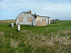
 Abandoned building on Grimsay | |
|---|---|
| Location | |
| Location: | 57°24’36"N, 7°16’48"W |
| Grid reference: | NF831473 |
| Area: | 289 acres |
| Highest point: | 66 feet |
| Data | |
| Population: | 19 |
Grimsay lies southeast of Benbecula. It is a tidal island of the Outer Hebrides, belonging to Inverness-shire. It is connected to Benbecula by a causeway which carries the B891. In the 2001 census, Grimsay had a population of just 19.
An extension to the B891 now connects Grimsay to Eilean na Cille to the south east by a causeway. The road was built at a cost of £1,800 to service the pier at Peter's Port, which was constructed in 1896 at cost of £2,000 - although the anchorage is awkward and should not be used without local knowledge.[1]

References
- ↑ Haswell-Smith (2004) pp. 243, 250-51
- Haswell-Smith, Hamish (2004). The Scottish Islands. Edinburgh: Canongate. ISBN 1841954543.