Marshfield, Monmouthshire
| Marshfield | |
| Monmouthshire | |
|---|---|
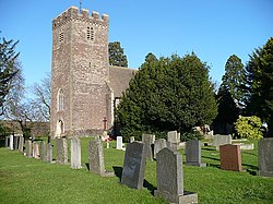
 File:St Mary's Church, Marshfield | |
| Location | |
| Grid reference: | ST275833 |
| Location: | 51°32’38"N, 3°2’49"W |
| Data | |
| Population: | 2,636 (2011) |
| Post town: | Cardiff |
| Postcode: | CF3 |
| Dialling code: | 01633 |
| Local Government | |
| Council: | Newport |
| Parliamentary constituency: |
Newport West |
Marshfield is a village and parish on the Wentloog level in southwest Monmouthshire. The parish contains the village of Castleton as well as Marshfield itself. It is considered to be an affluent and sought-after area.
The parish contains a Village Hall, post office and convenience store. There was formerly a railway station, an intermediate stop on the line between Newport and Cardiff, but it was closed in 1959.
Outside links
- www.geograph.co.uk : photos of Marshfield and surrounding area
- www.marshfieldcommunitycouncil.org.uk : Marshfield Community Council

This Monmouthshire article is a stub: help to improve Wikishire by building it up.