Upend
| Upend | |
| Cambridgeshire | |
|---|---|
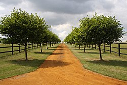
 Footpath through a stud farm to Upend | |
| Location | |
| Grid reference: | TL705575 |
| Location: | 52°11’50"N, -0°29’12"E |
| Data | |
| Local Government | |
| Website: | Kirtling & Upend |
Upend is a hamlet in the south-east of Cambridgeshire, southeast of Newmarket and drawn into that town's chief industry, as there are stud farms here and beyond.
Kirtling, in which parish it lies, is to the southwest.

This Cambridgeshire article is a stub: help to improve Wikishire by building it up.