Little Abington
| Little Abington | |
| Cambridgeshire | |
|---|---|

| |
| Location | |
| Grid reference: | TL529493 |
| Location: | 52°7’17"N, -0°13’57"E |
| Data | |
| Postcode: | CB21 |
| Local Government | |
| Council: | South Cambridgeshire |
| Parliamentary constituency: |
South East Cambridgeshire |
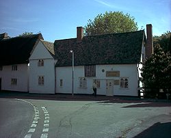
Little Abington is a village in south-eastern Cambridgeshire, some 7 miles southeast of Cambridge. Little Abington and its neighbour Great Abington are known as The Abingtons: the two parishes are divided by the River Granta.
The parish of Little Abington covers 1,309 acres, again bordered by the Icknield Way and Hildersham to the west and east, and by the ancient thoroughfare of Wool Street to the north.[1]
Churches
Little Abington has two churches:
- Church of England: St Mary’s
- United Reformed Church
The parish church is dedicated to St Mary as is Great Abington's, and has been since at least the 16th century. The present building consists of a chancel, nave with north chapel and south porch, and west tower. The nave is believed to date from around 1100, and the chancel was rebuilt in the 13th century. The three-storey tower is probably 14th century.
The United Reformed Church was first built as a non-conformist chapel towards the end of the 19th century.
History
Bronze Age traces have been found, from some 4,000 years ago.
The villages of Great and Little Abington have been separate at least since the Norman Conquest, when the two manors on either side of the River Granta were allotted to different lords.
Outside links
| ("Wikimedia Commons" has material about Little Abington) |
