Drygalski Fjord
From Wikishire
Revision as of 23:52, 2 February 2013 by RB (Talk | contribs) (Created page with 'Drygalski Fjord Southeast extremity of South Georgia with Drygalski Fjord {{#var…')
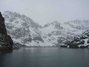
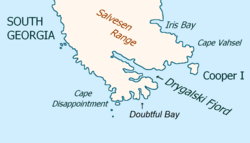
Drygalski Fjord is a bay a mile wide which recedes northwestwards 7 miles, entered immediately north of Nattriss Head along the southeast coast of South Georgia. It was charted by the Second German Antarctic Expedition, 1911–12, under Wilhelm Filchner, and named for Professor Erich von Drygalski, the leader of the First German Antarctica Expedition, 1901–03.
According to L. Harrison Matthews, Drygalski Fjord might have been the place where Anthony de la Roché spent two weeks during his stay in the island in April 1675.
References
Gazetteer and Map of South Georgia and the South Sandwich Islands: Drygalski Fjord
Coordinates: 54°49′S 36°0′W / 54.817°S 36°W
This South Georgia and the South Sandwich Islands article is a stub: help to improve Wikishire by building it up.
