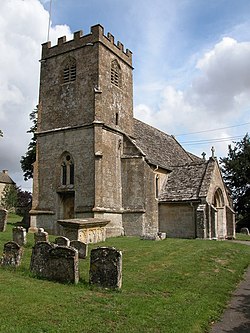
Hazleton
| Hazleton | |
| Gloucestershire | |
|---|---|
 Hazleton Church | |
| Location | |
| Grid reference: | SP080179 |
| Location: | 51°51’38"N, 1°53’6"W |
| Data | |
| Population: | 168 (2011) |
| Post town: | Cheltenham |
| Postcode: | GL54 |
| Local Government | |
| Council: | Cotswold |
| Parliamentary constituency: |
The Cotswolds |
Hazleton is a little village in Gloucestershire, deep amongst the Cotswold Hills. The dominant building of the village is the parish church, St Andrew's.
The population of the civil parish at the 2011 Census was 224.
Outside links
| ("Wikimedia Commons" has material about Hazleton) |
References

This Gloucestershire article is a stub: help to improve Wikishire by building it up.
