East Butterwick
- Not to be confused with Butterwick, Lincolnshire
| East Butterwick | |
| Lincolnshire | |
|---|---|
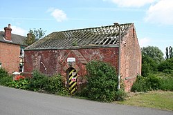
 Primitive Methodist Chapel, East Butterwick | |
| Location | |
| Grid reference: | SE836056 |
| Location: | 53°32’24"N, -0°44’18"W |
| Data | |
| Population: | 135 (2011) |
| Post town: | Scunthorpe |
| Postcode: | DN17 |
| Local Government | |
| Council: | North Lincolnshire |
| Parliamentary constituency: |
Brigg and Goole |
East Butterwick is a village and civil parish in Lincolnshire. It lies about four miles north-east from Epworth and the same distance north from Owston Ferry, on the eastern bank of the River Trent opposite its neighbour West Butterwick.[1] The population of the civil parish as at the 2011 census was 135.[2]
The civil parish corresponds to the township in the ancient parishes of Bottesford and Messingham.[3]
References
- ↑ Geograph
- ↑ "Civil parish population 2011". Neighbourhood Statistics. Office for National Statistics. http://www.neighbourhood.statistics.gov.uk/dissemination/LeadKeyFigures.do?a=7&b=11122944&c=East+Butterwick&d=16&e=62&g=6382490&i=1001x1003x1032x1004&m=0&r=1&s=1463325551288&enc=1. Retrieved 15 May 2016.
- ↑ East Butterwick township: A vision of Britain
| ("Wikimedia Commons" has material about East Butterwick) |

This Lincolnshire article is a stub: help to improve Wikishire by building it up.
