Connor Downs
| Connor Downs | |
| Cornwall | |
|---|---|
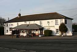
 The Turnpike Inn, Connor Downs | |
| Location | |
| Grid reference: | SW592391 |
| Location: | 50°12’14"N, 5°22’27"W |
| Data | |
| Postcode: | TR27 |
| Local Government | |
| Council: | Cornwall |
Connor Downs is a village in western Cornwall, near Gwinear and Gwithian, in whose joint civil parish it falls. The village is about two miles east of Hayle and about two miles south-southeast of Gwithian churchtown.
The name "Connor" was originally the name of Connerton, the mediæval manor of the parish of Gwithian.
[[File:]] The village straddles the old course of the A30 road but has now been bypassed and the new road passes to the north. Facilities include a school (Connor Downs Primary School), a petrol station and a fish-and-chip shop.
Outside links

| ("Wikimedia Commons" has material about Connor Downs) |
