Churt
| Churt | |
| Surrey | |
|---|---|
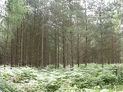
 Flat Wood near Churt | |
| Location | |
| Grid reference: | SU854382 |
| Location: | 51.136789) -0.779394 |
| Data | |
| Population: | 1,098 |
| Postcode: | GU10 |
| Local Government | |
| Council: | Waverley |
Churt is a village in the very southwest of Surrey. It stands on the A287 between Farnham and Hindhead, 3 miles north of the latter, and beside the brook which marks the border with Hampshire.
The village has its origins in the Anglo-Saxon period. The original boundary stones are visible at the junction of Green Lane and Green Cross Lane.
The village of Churt is recorded as being part of the "Great Sacks" that belonged to the Bishop of Winchester.
Frensham Great Pond, dug to provide the Bishop of Winchester, Hædde, with fresh fish, is the north border. Both the great and little pond were emptied during the Second World War as they were landmarks which could be of use to enemy bombers which might target Hankley, Bordon and Bramshott, which had a heavy military presence, but now lie full once again. The ponds have been used in numerous films.
References
Outside links
- Churt Village (parish council website)
- A Brief History Of Churt
- Listed Buildings in Churt, Surrey
- Stained Glass Windows at St John, Churt