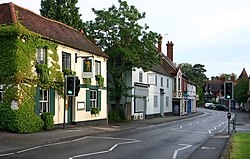
Bramley, Surrey
| Bramley | |
| Surrey | |
|---|---|
 Bramley | |
| Location | |
| Grid reference: | TQ008447 |
| Location: | 51°11’36"N, -0°33’27"W |
| Data | |
| Population: | 3,341 |
| Post town: | Guildford |
| Postcode: | GU5 |
| Dialling code: | 01483 |
| Local Government | |
| Council: | Waverley |
| Parliamentary constituency: |
South West Surrey |
Bramley is a village in south-western Surrey, lying some three miles south of Guildford. The parish is home to some 3,300 souls and most lies in the Surrey Hills Area of Outstanding Natural Beauty.
There is evidence of Iron Age settlement in the area, but the village began as an Anglo-Saxon settlement and expanded during the later middle ages. Many historic buildings have survived and the village is a conservation area.
References

This Surrey article is a stub: help to improve Wikishire by building it up.