Easton, Huntingdonshire
| Easton | |
| Huntingdonshire | |
|---|---|
 Easton | |
| Location | |
| Grid reference: | TL138718 |
| Location: | 52°19’58"N, 0°19’49"W |
| Data | |
| Population: | 162 (2001) |
| Post town: | Huntingdon |
| Postcode: | PE28 |
| Local Government | |
| Council: | Huntingdonshire |
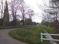
Easton is a village in Huntingdonshire, lying to the west of Huntingdon, between the villages of Ellington and Spaldwick.
The village has a 14th century parish church and a small park. It was a parish of just 162 souls as at the 2001 census.
Easton was listed in the Domesday Book.
Outside links

| ("Wikimedia Commons" has material about Easton, Huntingdonshire) |
References

This Huntingdonshire article is a stub: help to improve Wikishire by building it up.
