Jeffreyston
| Jeffreyston | |
| Pembrokeshire | |
|---|---|
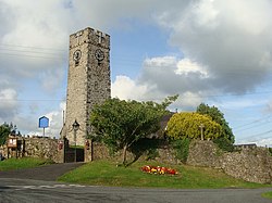
 Church of St Jeffrey and St Oswald | |
| Location | |
| Grid reference: | SN0894006593 |
| Location: | 51°43’30"N, 4°46’0"W |
| Data | |
| Post town: | Kilgetty |
| Postcode: | SA68 |
| Dialling code: | 01834 |
| Local Government | |
| Council: | Pembrokeshire |
| Parliamentary constituency: |
Carmarthen West and South Pembrokeshire |
Jeffreyston is a village and parish in Pembrokeshire.
Jeffreyston lies on the B4586 road about one mile west from the main A477 road; the nearest town is Tenby about six miles to the south and east. As well as Jeffreyston itself, the parish includes the settlements of Cresselly, Loveston and Yerbeston.
The parish church is dedicated to St Jeffrey and St Oswald and is a grade II* listed building.[1]
Cresselly House in the village of Cresselly is a Georgian country house, seat of the Allen family, which now also acts as a country house hotel and wedding venue.
References
- ↑ "Church of St. Jeffrey and St. Oswald, Jeffreyston". British Listed Buildings. http://www.britishlistedbuildings.co.uk/wa-6052-church-of-st-jeffrey-and-st-oswald-jeffrey. Retrieved 29 December 2013.

This Pembrokeshire article is a stub: help to improve Wikishire by building it up.