Gilwern
| Gilwern | |
| Brecknockshire | |
|---|---|
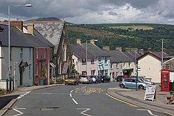
 The main road through Gilwern | |
| Location | |
| Grid reference: | SO244144 |
| Location: | 51°49’25"N, 3°5’50"W |
| Data | |
| Post town: | Abergavenny |
| Postcode: | NP7 |
| Local Government | |
| Council: | Monmouthshire |
Gilwern is a village in Brecknockshire, close by the village of Llanelly and near the boundary of Monmouthshire. It lies some four miles west of the town of Abergavenny in the latter county. The name of Gilwern is from the Welsh language and means "the nook near the alder grove".
Gilwern stands on the edge of the Brecon Beacons National Park. The local area has a history of iron production. The Monmouthshire and Brecon Canal, which passes through Gilwern, was built to transport coal and coke to service the Clydach ironworks.
Gilwern Hill lies to the south of the village.
Outside links
| ("Wikimedia Commons" has material about Gilwern) |
