Ben Donich
| Ben Donich | |||
| Argyllshire | |||
|---|---|---|---|
 Ben Donich | |||
| Range: | Arrochar Alps | ||
| Summit: | 2,776 feet NN218043 56°11’52"N, 4°52’26"W | ||
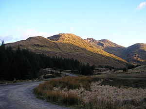
Ben Donich is a mountain in the Arrochar Alps, near Loch Goil, in Argyllshire, which reaches a height of 2,776 feet, earning it the title of a "Corbett".
The mountain is part of the Ardgoil peninsula, along with its sister The Brack. The nearest village to the mountain is Lochgoilhead.
At 2,776 feet, Ben Donich, is the highest mountain on the Ardgoil peninsula. It is a fairly extensive mountain, essentially a square pyramid with its summit at the centre of four ridges.
An Ordnance Survey trig point marks the summit.
Ascent
Ben Donich can be accessed by any of its four ridges, but is almost entirely surrounded by forestry plantations in its lower slopes which makes access difficult. To the northwest a ridge runs down to Gleann Mòr, whilst a further ridge kicks off to the south of the summit, dropping down into the wooded glen containing the Donich Water river.
By far the most frequented ridge is the southeast ridge which connects Ben Donich to The Brack by way of Bealach Dubh-lic at 1,260 feet, whence a footpath crosses over the ridge from Glen Croe to Lochgoilhead. A further insignificant ridge leads off the summit ridge to the northeast overlooking Glen Croe and the "Rest and be Thankful" summit on the A83.
The slopes are moderate, and terrain is mainly grass with some rocky outcrops on steeper slopes.