Buck of Cabrach: Difference between revisions
Jump to navigation
Jump to search
Created page with '{{Infobox hill |name=Buck of Cabrach |county 1=Aberdeenshire |county 2=Banffshire |range= |picture=View of The Buck (721m) - geograph.org.uk - 254547.jpg |os grid ref=NJ412234 |h…' |
No edit summary |
||
| Line 1: | Line 1: | ||
{{Infobox hill | {{Infobox hill | ||
|name=Buck of Cabrach | |name=Buck of Cabrach | ||
|county | |county=Aberdeenshire | ||
|range= | |range= | ||
|picture=View of The Buck (721m) - geograph.org.uk - 254547.jpg | |picture=View of The Buck (721m) - geograph.org.uk - 254547.jpg | ||
|os grid ref=NJ412234 | |os grid ref=NJ412234 | ||
|height=2,365 feet | |height=2,365 feet | ||
|latitude=57.2976 | |||
|longitude=-2.9758 | |||
}} | }} | ||
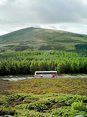
'''The Buck of Cabrach''', commonly called simply '''The Buck''', is a mountain | '''The Buck of Cabrach''', commonly called simply '''The Buck''', is a mountain in [[Aberdeenshire]]. The whole massif here is known as "Cabrach", but the hamlet of [[Cabrach]] itself lies a little off to the north-west. | ||
Many a climb will begin at a secondary peak, known as '''Meikle Carn''', at {{map|NJ420254}}, which rises to 1,526 feet by the B9002 road at Elrick. The Buck itself is to the south, its summit at {{map|NJ412234}}. | Many a climb will begin at a secondary peak, known as '''Meikle Carn''', at {{map|NJ420254}}, which rises to 1,526 feet by the B9002 road at Elrick. The Buck itself is to the south, its summit at {{map|NJ412234}}. The ridge on which the Buck lies marks the easternmost border the parish of Cabrach. | ||
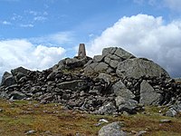
[[File:The Buck - geograph.org.uk - 349344.jpg|left|200px|The summit of the Buck]] | [[File:The Buck - geograph.org.uk - 349344.jpg|left|thumb|200px|The summit of the Buck]] | ||
Latest revision as of 13:01, 30 May 2024
| Buck of Cabrach | |
| Aberdeenshire | |
|---|---|

| |
| Summit: | 2,365 feet NJ412234 57°17’51"N, 2°58’33"W |
The Buck of Cabrach, commonly called simply The Buck, is a mountain in Aberdeenshire. The whole massif here is known as "Cabrach", but the hamlet of Cabrach itself lies a little off to the north-west.
Many a climb will begin at a secondary peak, known as Meikle Carn, at NJ420254, which rises to 1,526 feet by the B9002 road at Elrick. The Buck itself is to the south, its summit at NJ412234. The ridge on which the Buck lies marks the easternmost border the parish of Cabrach.
