Difference between revisions of "Upper Benefield"
From Wikishire
(Created page with "{{Infobox town |name=Upper Benefield |county=Northamptonshire |picture=Upper Benefield cottage - geograph.org.uk - 5293463.jpg |picture caption= |os grid ref=SP979892 |latitud...") |
(No difference)
|
Latest revision as of 20:31, 6 February 2024
| Upper Benefield | |
| Northamptonshire | |
|---|---|

| |
| Location | |
| Grid reference: | SP979892 |
| Location: | 52°29’34"N, 0°33’34"W |
| Data | |
| Post town: | Peterborough |
| Postcode: | PE8 |
| Dialling code: | 01832 |
| Local Government | |
| Council: | North Northamptonshire |
| Parliamentary constituency: |
Corby |
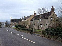
Upper Benefield is a village on the A427 road in Northamptonshire, near Oundle. Less than a mile to the south-east, parted by fields, is Lower Benefield.
The village is found six miles to the east of Corby.
The name 'Benefield' is from the Old English Beringafeld, which means 'Bera's people's field'.[1]
| ("Wikimedia Commons" has material about Upper Benefield) |