Difference between revisions of "Grimstone, Dorset"
From Wikishire
(Created page with "{{Infobox town |name=Grimstone |county=Dorset |picture=GrimstoneRoyalYeoman.JPG |picture caption=The Royal Yeoman, Grimstone |os grid ref=SY639941 |latitude=50.73 |longitude=...") |
(No difference)
|
Latest revision as of 21:46, 28 August 2023
| Grimstone | |
| Dorset | |
|---|---|
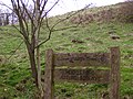
 The Royal Yeoman, Grimstone | |
| Location | |
| Grid reference: | SY639941 |
| Location: | 50°43’48"N, 2°31’12"W |
| Data | |
| Post town: | Dorchester |
| Postcode: | DT2 |
| Dialling code: | 01305 |
| Local Government | |
| Council: | Dorset |
| Parliamentary constituency: |
West Dorset |
| Website: | Stratton Dorset |
Grimstone is a hamlet at the meeting of the of Sydling Water and the River Frome in Dorset.
The Great Western Railway opened Grimstone and Frampton railway station and Grimstone Viaduct in 1857 and British Railways closed the station in 1966.
The hamlet is the home of Manor Foods, a catering company located at Manor Farm.[1]
Grimstone's common lands were not enclosed until 1907.[2]
Gallery
| ("Wikimedia Commons" has material about Grimstone, Dorset) |

Former water mill
Muckleford Nature Reserve


References
- ↑ Rogers, Joseph (2016). A Spectrum Of Settlements. Blurb Inc. pp. 202. ISBN 9781364234751.
- ↑ Taylor, Christopher (1982). Fields in the English Landscape. Archaeology in the Field Series. London: J.M. Dent & Sons Ltd. p. 153. ISBN 0-460-02232-6.