Difference between revisions of "Tullyhogue"
From Wikishire
(Created page with "{{Infobox town |name=Tullyhogue |county=Tyrone |picture=Halfway Bar, Tullyhogue, near Cookstown - geograph.org.uk - 567401.jpg |picture caption=Halfway Bar in Tullyhogue |os g...") |
(No difference)
|
Latest revision as of 21:12, 6 December 2022
| Tullyhogue | |
| Tyrone | |
|---|---|
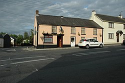
 Halfway Bar in Tullyhogue | |
| Location | |
| Grid reference: | H825738 |
| Location: | 54°36’22"N, 6°43’24"W |
| Data | |
| Post town: | Cookstown |
| Postcode: | BT80 |
| Dialling code: | 028 |
| Local Government | |
| Council: | Mid-Ulster |
Tullyhogue, also called Tullaghoge, is a small village and townland[1] in Tyrone, about two miles south of Cookstown.
Nearby Tullyhogue Fort was the crowning place of the kings of Tír Eoghain until the Flight of the Earls in 1607.
Outside links
| ("Wikimedia Commons" has material about Tullyhogue) |
References
- ↑ Tullyhogue - Placenames NI