Mount Charity: Difference between revisions
Created page with "{{Infobox hill |name=Mount Faith |territory=British Antarctic Territory |picture=Mount Charity, Antarctica.jpg |picture caption=Mount Charity view from east |latitude=-69.9 |l..." |
|||
| Line 19: | Line 19: | ||
{{reflist}} | {{reflist}} | ||
*{{ | *{{basgaz}} | ||
Latest revision as of 09:54, 5 December 2022
| Mount Faith | |||
| British Antarctic Territory | |||
|---|---|---|---|
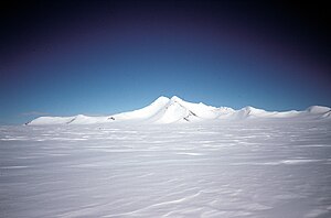
 Mount Charity view from east | |||
| Range: | Eternity Range | ||
| Summit: | 8,793 feet 69°54’0"S, 64°34’0"W | ||
Mount Charity is mountain in the Eternity Range in the north of Palmer Land. It is to be found nine nautical miles south of Mount Hope, the range's and the territory's highest mountain, and rises to 8,793 feet at the southern end of the range.
This mountain was first seen from the air and named by Lincoln Ellsworth, an American polar explorer, during his flights of 21 and 23 November 1935. It was surveyed by John Riddoch Rymill of the British Graham Land Expedition in November 1936. The mountain was subsequently photographed from the air by the United States Antarctic Service in September 1940, and by the Ronne Antarctic Research Expedition in December 1947.
The feature is one of three major mountains Ellsworth's named in the range he called 'Eternity'; the three being Mounts Faith, Hope Charity.
References
- Gazetteer and Map of The British Antarctic Territory: Mount Charity