Difference between revisions of "Lower Common"
From Wikishire
(Created page with "{{Infobox town |name=Lower Common |county=Hampshire |picture=Lower Common, Eversley - geograph 6676783.jpg |picture caption=Lower Common |os grid ref=SU768621 |latitude=51.353...") |
(No difference)
|
Latest revision as of 12:55, 15 October 2022
| Lower Common | |
| Hampshire | |
|---|---|
 Lower Common | |
| Location | |
| Grid reference: | SU768621 |
| Location: | 51°21’11"N, 0°53’56"W |
| Data | |
| Post town: | Yateley |
| Postcode: | GU51 |
| Local Government | |
| Council: | Hart |
| Parliamentary constituency: |
North East Hampshire |
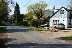
Lower Common is a village in the very northernmost of Hampshire, on the south bank of the River Blackwater, which here marks the border of Berkshire. It is effectively a hamlet grown on a dead-end lane westwards out of Eversley, its neighbouring village.
The nearest village of any size is Yateley, three miles to the south-east of Lower Common.