Nutfield, Surrey: Difference between revisions
Created page with "{{Infobox town |name=Nutfield |country=Surrey |picture=St Peter and St Paul's Church, Church Hill, Nutfield (NHLE Code 1377573).JPG |picture caption=St Peter and St Paul's Ch..." |
|||
| Line 28: | Line 28: | ||
The Grade II* listed St Peter and St Paul's church was built in the 13th century. The tower dates from the early 15th century but was partly rebuilt in the late 18th century.<ref>[https://www.nutfieldparishchurch.org.uk/history.htm Nutfield Parish Church: History]</ref> There are two stained glass windows by Edward Burne-Jones.<ref>{{NHLE|1377573|Church of St Peter and St Paul|grade=II*}}</ref> | The Grade II* listed St Peter and St Paul's church was built in the 13th century. The tower dates from the early 15th century but was partly rebuilt in the late 18th century.<ref>[https://www.nutfieldparishchurch.org.uk/history.htm Nutfield Parish Church: History]</ref> There are two stained glass windows by Edward Burne-Jones.<ref>{{NHLE|1377573|Church of St Peter and St Paul|grade=II*}}</ref> | ||
The Grade II listed [[Nutfield Priory]], to the west of the village centre, was constructed by John Gibson | The Grade II listed [[Nutfield Priory]], to the west of the village centre, was constructed by John Gibson in 1872–4.<ref>{{NHLE|1400998|Nutfield Priory, Nutfield|grade=II}}</ref> | ||
{{commons}} | {{commons}} | ||
==References== | ==References== | ||
{{reflist}} | {{reflist}} | ||
Latest revision as of 18:16, 21 July 2022
| Nutfield | |
| [[]] | |
|---|---|
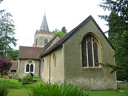
 St Peter and St Paul's Church | |
| Location | |
| Grid reference: | TQ309506 |
| Location: | 51°14’23"N, 0°7’33"W |
| Data | |
| Population: | 2,673 (2011) |
| Post town: | Redhill |
| Postcode: | RH1 |
| Dialling code: | 01737 |
| Local Government | |
| Council: | Tandridge |
Nutfield is a village in the south-west of Surrey, in the county's Reigate Hundred. It is in the Weald immediately south of the Greensand Ridge and has a railway station, at South Nutfield, one stop from Redhill, which allows it to be a commuter village.
The village centre stretches south from the A25 towards Nutfield Station, around which the neighbourhood of Nutfield South has grown, exceeding its parent village in size. North of the A25 is Nutfield Marsh. Also to the north of the A25 is Nutfield Court, a former country house that has been redeveloped into apartments, adjacent to St Peter & St Paul's church.
There is a watersports park and picnic destination, Mercers Country Park.
History
Nutfield appears in Domesday Book of 1086 as Notfelle. It was held by Countess Ida of Boulogne (second wife of Count Eustace). Its Domesday assets were: 3 hides; 1 church, 16 ploughs, 1 mill worth 2s, 10 acre of meadow, herbage worth 12 hogs. It rendered £15 per year.[1]
At the end of the 12th century, Nutfield was held by Hubert de Anstey and his wife Dionysia, then in 1210 it passed to his son and heir Nicholas de Anstey.[2]
The Grade II* listed St Peter and St Paul's church was built in the 13th century. The tower dates from the early 15th century but was partly rebuilt in the late 18th century.[3] There are two stained glass windows by Edward Burne-Jones.[4]
The Grade II listed Nutfield Priory, to the west of the village centre, was constructed by John Gibson in 1872–4.[5]
| ("Wikimedia Commons" has material about Nutfield, Surrey) |
References
- ↑ and South Nutfield Nutfield, Surrey in the Domesday Book
- ↑ Anstey, G.M. and T.J. (2017). ANSTEY: Our True Surname Origin and Shared Mediæval Ancestry. pp. 126.
- ↑ Nutfield Parish Church: History
- ↑ National Heritage List 1377573: Church of St Peter and St Paul (Grade II* listing)
- ↑ National Heritage List 1400998: Nutfield Priory, Nutfield (Grade II listing)
