Sgwd Clun-gwyn: Difference between revisions
Jump to navigation
Jump to search
Created page with "{{Infobox waterfall |name= Sgwd Clun-gwyn |county=Brecknockshire |picture= Sgand^373,d Uchaf Clyn Glyn - geograph.org.uk - 70655.jpg |picture caption=Sgwr Clun-gwyn |os grid r..." |
(No difference)
|
Revision as of 21:12, 24 June 2019
| Sgwd Clun-gwyn | |
| Brecknockshire | |
|---|---|
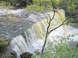
 Sgwr Clun-gwyn | |
| River: | River Mellte |
| SN92471094 | |
| Co-ordinates: | 51°47’12"N, 3°33’37"W |
Sgwd Clun-gwyn, whose name means 'Fall of the white meadow' is the uppermost of the three celebrated falls on the River Mellte in Brecknockshire. It is also known as Sgwd Uchaf Clun-gwyn ('Upper Fall of the whire meadow').
This waterfall and its neighbours are part of Brecknockshire's Waterfall Country, which encompasses many beautiful waterfalls on the rivers running from the southern slopes of the Brecon Beacons.
The fall is formed where a north-northwest to south-southeast trending geological fault brings hard sandstone up against softer mudstone.
See also
Outside links
- Pictures of Sgwd Clun-gwyn and the area on Geograph.co.uk
- Four Waterfalls walk – Caving UK
- Waterfall County walking trails – Brecon Beacons NPA