Tinkers Hill: Difference between revisions
Jump to navigation
Jump to search
Created page with '{{Infobox hill |name=Tinkers Hill |county=Worcestershire |picture=Tinker's Hill - geograph.org.uk - 696576.jpg |picture caption=Tinkers Hill |height=699 feet |range=Malvern Hills…' |
No edit summary |
||
| Line 6: | Line 6: | ||
|height=699 feet | |height=699 feet | ||
|range=Malvern Hills | |range=Malvern Hills | ||
|latitude=52.056979 | |||
|longitude=-2.344152 | |||
|os grid ref=SO765399 | |os grid ref=SO765399 | ||
}} | }} | ||
'''Tinkers Hill''' in [[Worcestershire]] is in the range of [[Malvern Hills]] that runs approximately | '''Tinkers Hill''' in [[Worcestershire]] is in the range of [[Malvern Hills]] that runs approximately eight miles north-south along the [[Herefordshire]]-[[Worcestershire]] border. It lies on the eastern side of the main ridge to the east of [[Herefordshire Beacon]] with views across the [[Vale of Evesham]] and the [[Cotswolds]].<ref name=Smart2009>{{cite book | ||
| last=Smart | | last=Smart | ||
| first=Mike | | first=Mike | ||
| Line 30: | Line 32: | ||
==References== | ==References== | ||
[[File:Farm road from Underhill Farm - geograph.org.uk - 754162.jpg| | [[File:Farm road from Underhill Farm - geograph.org.uk - 754162.jpg|thumb|200px|Farm road below Tinkers Hill]] | ||
{{reflist}} | {{reflist}} | ||
Latest revision as of 18:40, 29 August 2018
| Tinkers Hill | |||
| Worcestershire | |||
|---|---|---|---|
 Tinkers Hill | |||
| Range: | Malvern Hills | ||
| Summit: | 699 feet SO765399 52°3’25"N, 2°20’39"W | ||
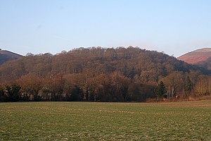
Tinkers Hill in Worcestershire is in the range of Malvern Hills that runs approximately eight miles north-south along the Herefordshire-Worcestershire border. It lies on the eastern side of the main ridge to the east of Herefordshire Beacon with views across the Vale of Evesham and the Cotswolds.[1] Its summit reaches a height of 699 feet.
The hilltop is level and wooded. The British Camp Reservoir lies in the cup between Tinkers Hill, the Herefordshire Beacon and Broad Down.
In June 2004, the Worcestershire Bat Group identified Tinkers hill wood as being home to a colony of barbastelles, a species of bat protected under the European Habitats Directive.[2]
References

- ↑ Smart, Mike (2009). Malvern Hills. Frances Lincoln Ltd. p. 15. ISBN 0-7112-2915-5.
- ↑ "Barbastelles on the Malvern Hills". Worcestershire Bat Group. 22 July 2009. http://worcestershirebats.btck.co.uk/BarbastellesontheMalvernHills. Retrieved 13 December 2011.