Bellever Tor: Difference between revisions
Jump to navigation
Jump to search
Created page with "{{Infobox hill |name=Bellever Tor |county=Devn |range=Dartmoor |picture=Bellever Tor - geograph.org.uk - 208200.jpg |picture caption=Bellever Tor |os grid ref=SX644764 |latitu..." |
mNo edit summary |
||
| Line 1: | Line 1: | ||
{{Infobox hill | {{Infobox hill | ||
|name=Bellever Tor | |name=Bellever Tor | ||
|county= | |county=Devon | ||
|range=Dartmoor | |range=Dartmoor | ||
|picture=Bellever Tor - geograph.org.uk - 208200.jpg | |picture=Bellever Tor - geograph.org.uk - 208200.jpg | ||
Revision as of 12:54, 3 April 2018
| Bellever Tor | |||
| Devon | |||
|---|---|---|---|
 Bellever Tor | |||
| Range: | Dartmoor | ||
| Summit: | 1,453 feet SX644764 50°34’19"N, 3°54’56"W | ||
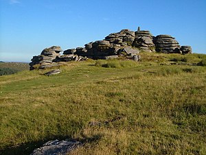
Bellever Tor is a rock-clad hill on Dartmoor, rising to 1,453 feet, on the High Moor between Two Bridges and Postbridge. At the foot of its eastern slope sits the hamlet of Bellever, on the East Dart River.
The hillside is rich in prehistoric archaeology: there are hut circles and other settlement remains, and cairn and cist sites, as in much of this part of the high moor.
The flanks of the hill are swallowed in the Bellever Forest, a small plantation by the Forestry Commission.
Outside links
- Bellever Tor walk - Divine Devon
The summit of the tor has the granite outcrops typifying Dartmoor, and it topped with an Ordnance Survey trig pillar.