Loch Tarbert: Difference between revisions
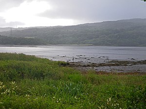
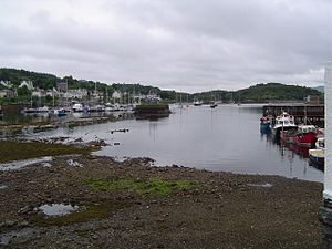
Created page with "{{county|Argyll}} thumb|West Loch Tarbert viewed from the western shore. Image:Tarbert.JPG|thumb|East Loch Tarbert, looking tow..." |
|||
| Line 25: | Line 25: | ||
{{reflist}} | {{reflist}} | ||
[[Category:Sea lochs of Argyllshire]] | [[Category:Sea lochs of Argyllshire|Tarbert]] | ||
Latest revision as of 11:25, 10 February 2017


Loch Tarbert is the name for two sea lochs either side of the Kintyre peninsula of Argyllshire.
Geography
East Loch Tarbert lies on the eastern side of the Kintyre peninsula, separated from West Loch Tarbert on the west by by an isthmus only a mile long.[1]
The head of the West Loch Tarbert lies near the village of Tarbert and it reaches the open sea at Ardpatrick Point some ten miles distant.[2]
The island of Eilean Ceann na Creige, off the south shore, is connected to the mainland by a causeway. It is the ferry terminal for Islay.[3]
History
Around the year 1093, Magnus Barefoot, King of Norway had his longship dragged across the isthmus at Tarbert between West Loch Tarbert and East Loch Tarbert as part of a campaign to increase his possessions in the Hebrides. He made an arrangement with King Malcolm III that he could take possession of land on the west coast around which a ship could sail. Magnus declared that Kintyre had "better land than the best of the Hebrides", and by taking command of his ship's tiller and "sailing" across the isthmus he was able to claim the entire peninsula, which remained under Norse rule for more than a dozen years as a result.[4]
More than two centuries later Robert the Bruce completed a similar feat during the Scottish Wars of Independence in order to impress the clan chieftains of Argyll. He used tree trunks as rollers.[5] g In the 18th century Thomas Pennant recorded that sea-going vessels of up to 10 tons were being hauled over the isthmus in order to avoid the dangers of storms and tidal races in the seas surrounding the Mull of Kintyre. James Watt surveyed the area and decided that it was feasible to construct a canal between the two lochs. Some 60 years later it was estimated that the cost for a cut without locks would be £90,000 but delays in implementation and the construction of the Crinan Canal in 1801 rendered the plan redundant.[5]
Maps
- East Loch Tarbert: 55°52’3"N, 5°23’55"W
- West Loch Tarbert: 55°48’-0"N, 5°30’30"W
Footnotes
- ↑ "West Loch Tarbert" Gazetteer for Scotland. Retrieved 13 September 2008.
- ↑ "West Loch Tarbert". Gazetteer for Scotland. http://www.scottish-places.info/features/featurefirst4041.html. Retrieved 13 September 2008.
- ↑ "Crossings: Kennacraig". Ships of Calmac. http://www.shipsofcalmac.co.uk/crossing_ki.asp. Retrieved 2009-09-03.
- ↑ Murray, W.H. (1977) The Companion Guide to the West Highlands of Scotland. London. Collins. p. 100.
- ↑ 5.0 5.1 Murray (1977) pp. 100–01.