Difference between revisions of "Carlin Tooth"
From Wikishire
(Created page with "{{Infobox hill |name=Carlin Tooth |county=Roxburghshire |range=Cheviot Hills |picture=Carlin Tooth - geograph.org.uk - 303478.jpg |picture caption=View from the summit of Carl...") |
(No difference)
|
Latest revision as of 17:53, 31 August 2015
| Carlin Tooth | |||
| Roxburghshire | |||
|---|---|---|---|
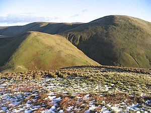
 View from the summit of Carlin Tooth | |||
| Range: | Cheviot Hills | ||
| Summit: | 1,808 feet NT631024 55°18’55"N, 2°34’50"W | ||
Carlin Tooth is a hill amongst the Cheviot Hills, in Roxburghshire, just north of the ridge which marks the boundary with Northumberland.