Esher: Difference between revisions
Created page with '{{Infobox town |name=Esher |county = Surrey |picture= Esher, Fountain on The Green - geograph.org.uk - 106982.jpg |picture caption= Fountain on Esher High Street |os grid ref= …' |
Adding material |
||
| Line 17: | Line 17: | ||
The village's main axes are the Portsmouth Road, containing the High Street on which are its main shops, and meeting it the residential roads, Lammas Lane from the west and Claremont Lane from the south. Esher railway station runs to London Waterloo, providing a route for the many commuters who live in Esher. | The village's main axes are the Portsmouth Road, containing the High Street on which are its main shops, and meeting it the residential roads, Lammas Lane from the west and Claremont Lane from the south. Esher railway station runs to London Waterloo, providing a route for the many commuters who live in Esher. | ||
Moore Place, on the outskirts of Esher is now a bar and restaurant. The Moore Place Estate remains a private estate. | |||
Sandown Park Racecourse lies in the town, stretching along the Portsmouth Road. | Sandown Park Racecourse lies in the town, stretching along the Portsmouth Road. | ||
| Line 33: | Line 35: | ||
There is a local farmers market held on one Saturday every month, moving forward one week each month. Vendors from all over Surrey sell locally sourced produce. | There is a local farmers market held on one Saturday every month, moving forward one week each month. Vendors from all over Surrey sell locally sourced produce. | ||
==West End== | |||
[[File:West end common1.jpg|right|thumb|200px|The Common, West End]] | |||
West End is a separate village south-west of Esher on the River Mole. It is gathered around a large village green with two ponds, and meadows running down to the river, used for public recreation. The main farmland of Esher is in and around West End. In West End is the woodland of "Horseshoe Clump", which becomes Esher Common. | |||
==History== | ==History== | ||
Revision as of 16:26, 14 November 2010
| Esher | |
| Surrey | |
|---|---|
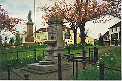
 Fountain on Esher High Street | |
| Location | |
| Grid reference: | TQ145645 |
| Location: | 51°22’9"N, 0°21’54"W |
| Data | |
| Population: | 8,387 |
| Post town: | Esher |
| Postcode: | KT10 |
| Dialling code: | 01372 |
| Local Government | |
| Council: | Elmbridge |
| Parliamentary constituency: |
Esher and Walton |
Esher is a prosperous town or village in northern Surrey. It stands on a hill above the River Mole. Esher is largely suburban in character, home to commuters and the well-to-do.
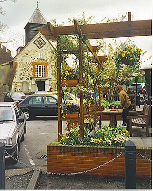
The village's main axes are the Portsmouth Road, containing the High Street on which are its main shops, and meeting it the residential roads, Lammas Lane from the west and Claremont Lane from the south. Esher railway station runs to London Waterloo, providing a route for the many commuters who live in Esher.
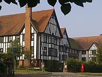
Moore Place, on the outskirts of Esher is now a bar and restaurant. The Moore Place Estate remains a private estate.
Sandown Park Racecourse lies in the town, stretching along the Portsmouth Road.
Esher lies within the hundred of Elmbridge. The local newspaper is the Esher News and Mail.[1]
Churches

- Church of England:
- Christ Church – the parish church
- St George's Church – Esher's oldest public building, built in 1540, the former parish church, now used for occasional services and in the care of the Churches Conservation Trust
- Baptist: Esher Green Baptist Church
- Cornerstone
Markets
There is a local farmers market held on one Saturday every month, moving forward one week each month. Vendors from all over Surrey sell locally sourced produce.
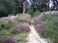
West End

West End is a separate village south-west of Esher on the River Mole. It is gathered around a large village green with two ponds, and meadows running down to the river, used for public recreation. The main farmland of Esher is in and around West End. In West End is the woodland of "Horseshoe Clump", which becomes Esher Common.
History
Esher first appears in writing in a charter of King Ethelred I of 911, as Æsceron. In the Domesday Book of 1086 it is written Aissela and Aissele. It was held partly by the Abbey of the Cross in Normandy; partly by William de Waterville; partly by Reginald; partly by Hugh do Port; partly by Odard Balistarius. Its Domesday assets were: 14 hides 6 ploughs, 2 acres of meadow. It rendered £6 2s 0d.[2]
Esher grew as a stagecoach stop on the Portsmouth Road, which was later designated as the A3, although it was bypassed in the mid-1970s, the Portsmouth Road in Esher becoming the A307.
In the 16th century, King Henry VIII used the area as a royal hunting ground, and the town remained wealthy. Clive of India built the Claremont mansion, and this later became a royal residence used by Queen Victoria. Prince Leopold of Saxe-Coburg lived there until he became King of the Belgians. Queen Victoria lent the house to the exiled French King Louis-Philippe and his consort Queen Marie-Amalie after the revolution of 1848. The Orléans Arms is named in their honour
Status in the media

Esher has been presented in some parts of the media as a particularly middle class part of suburbia.
Monty Python referred to Esher at least three times. In episode 9 Terry Jones dressed as an 'African Native' said: 'Full frontal nudity? Not in this part of Esher.' In episode 31, a tourist played by Eric Idle complaining about package holidays ranted about 'middle-class stockbrokers' wives busily buying identical holiday villas in suburban development plots just like Esher, in case the Labour government gets in again…' Then in episode 36, a character played by Michael Palin was complaining about a rare disease that affected his use of language and stated: 'It's so embarrassing when my wife and I go to an orgy.' John Cleese's character responded: 'A party?!' To which Palin responded: 'No, an orgy. We live in Esher.'
Esher was often referred to in The Good Life by Margo Leadbetter as both a place to aspire to after Surbiton and somewhere where behaviour was more lax.