St Andrews Bay, South Georgia: Difference between revisions
Jump to navigation
Jump to search
Created page with 'right|thumb|300px|St Andrews Bay with the penguin colony '''Saint Andrews Bay''' is a bight 2 miles wide, indenting the north coast of…' |
|||
| Line 9: | Line 9: | ||
==Outside links== | ==Outside links== | ||
{{commons}} | |||
*{{basgaz}} | |||
*[http://www.panoramio.com/photo/1456882 Image of Saint Andrews Bay] | *[http://www.panoramio.com/photo/1456882 Image of Saint Andrews Bay] | ||
[[Category:Bays of South Georgia]] | [[Category:Bays of South Georgia]] | ||
Revision as of 21:19, 9 August 2021

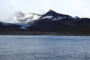
Saint Andrews Bay is a bight 2 miles wide, indenting the north coast of South Georgia immediately south of Mount Skittle. It was probably first sighted by the British expedition under James Cook which explored the north coast of South Georgia in 1775.
The name “St Andrews Bay” dates back to at least 1920 and is now well established.
King Penguins form huge breeding colonies - and the one at St Andrews Bay has over 100,000 birds. Because of the long breeding cycle, colonies are continuously occupied.
Ross Glacier which is nearby is retreating, and leaving a gravel beach in its wake. Heaney Glacier and Cook Glacier also are in the vicinity.
Outside links
| ("Wikimedia Commons" has material about St Andrews Bay, South Georgia) |
- Gazetteer and Map of the BAT and SGSSI: St Andrews Bay, South Georgia
- Image of Saint Andrews Bay
