Saughieside Hill: Difference between revisions
Jump to navigation
Jump to search
Created page with "{{Infobox hill |name=Saughieside Hill |county=Northumberland |range=Cheviot Hills |picture=South East from Madam Law - geograph.org.uk - 150700.jpg |picture caption=Saughiesid..." |
No edit summary |
||
| Line 9: | Line 9: | ||
|latitude=55.518223 | |latitude=55.518223 | ||
|longitude=-2.209290 | |longitude=-2.209290 | ||
}} | }} | ||
'''Saughieside Hill''' is a hill amongst the [[Cheviot Hills]], in [[Northumberland]], in the north of the range. | '''Saughieside Hill''' is a hill amongst the [[Cheviot Hills]], in [[Northumberland]], in the north of the range. | ||
Revision as of 15:50, 31 August 2016
| Saughieside Hill | |||
| Northumberland | |||
|---|---|---|---|
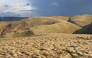
 Saughieside, with Black Hag behind | |||
| Range: | Cheviot Hills | ||
| Summit: | 1,847 feet NT868249 55°31’6"N, 2°12’33"W | ||
Saughieside Hill is a hill amongst the Cheviot Hills, in Northumberland, in the north of the range.
Saughieside stands on the east side of Steer Rig, the ridge between Black Hag and White Law which carries the Pennine Way and marks the boundary of Northumberland to the east and Roxburghshire to the west. To the east is Blackhaggs Rig, over which the land falls away into the College Valley.
Outside links
| ("Wikimedia Commons" has material about Saughieside Hill) |
