Coates, Nottinghamshire: Difference between revisions
Jump to navigation
Jump to search
Created page with "{{Infobox town |name=Coates |county=Nottinghamshire |picture= |picture caption= |os grid ref=SK820813 |latitude=53.32 |longitude=-0.77 |population= |post town=Retforrd |postco..." |
No edit summary |
||
| Line 2: | Line 2: | ||
|name=Coates | |name=Coates | ||
|county=Nottinghamshire | |county=Nottinghamshire | ||
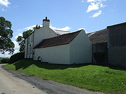
|picture= | |picture=Corner Farm, Coates, Nottinghamshire - geograph 3512155.jpg | ||
|picture caption= | |picture caption=Corner Farm, Coates | ||
|os grid ref=SK820813 | |os grid ref=SK820813 | ||
|latitude=53.32 | |latitude=53.32 | ||
Latest revision as of 13:47, 21 August 2021
| Coates | |
| Nottinghamshire | |
|---|---|
 Corner Farm, Coates | |
| Location | |
| Grid reference: | SK820813 |
| Location: | 53°19’12"N, -0°46’12"W |
| Data | |
| Post town: | Retforrd |
| Postcode: | DN22 |
| Local Government | |
| Council: | Bassetlaw |
| Parliamentary constituency: |
Bassetlaw |
Coates is a hamlet in Nottinghamshire. It is located eight miles south of Gainsborough. on the west bank of the River Trent.

This Nottinghamshire article is a stub: help to improve Wikishire by building it up.