Template:FP-Trostan: Difference between revisions
Jump to navigation
Jump to search
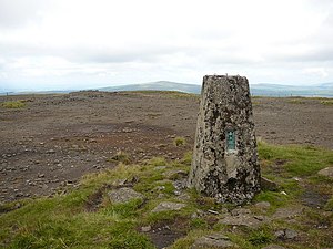
Created page with "{{#switch:{{{1}}} |pic=Trig point at summit of Trostan - geograph.org.uk - 642884.jpg |cap=The summit of Trostan |text='''Trostan''' is a mountain in County Antrim, amongs..." |
No edit summary |
||
| Line 4: | Line 4: | ||
|text='''Trostan''' is a mountain in [[County Antrim]], amongst the Antrim Hills and rising to 1,808 feet at its summit, it is the highest point in the county. Westward is the Slieveanorra Forest and to the southeast is the Glenariff Forest Park. | |text='''Trostan''' is a mountain in [[County Antrim]], amongst the Antrim Hills and rising to 1,808 feet at its summit, it is the highest point in the county. Westward is the Slieveanorra Forest and to the southeast is the Glenariff Forest Park. | ||
On the slopes of Trostan rise the burns which run down into several of the Glens of Antrim: the Glenaan River, which carves Glenaan, the Glendun River of Glendun, and others.}}<noinclude>{{ | On the slopes of Trostan rise the burns which run down into several of the Glens of Antrim: the Glenaan River, which carves Glenaan, the Glendun River of Glendun, and others.}}<noinclude>{{FP data}} | ||
Latest revision as of 09:06, 9 May 2021
 |
TrostanTrostan is a mountain in County Antrim, amongst the Antrim Hills and rising to 1,808 feet at its summit, it is the highest point in the county. Westward is the Slieveanorra Forest and to the southeast is the Glenariff Forest Park. On the slopes of Trostan rise the burns which run down into several of the Glens of Antrim: the Glenaan River, which carves Glenaan, the Glendun River of Glendun, and others. (Read more) |