Upper Plym Valley: Difference between revisions
Jump to navigation
Jump to search
Redirected page to Plym Valley |
No edit summary |
||
| Line 1: | Line 1: | ||
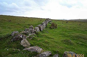
[[File:Reaves at Hen Tor Warren - Dartmoor - geograph.org.uk - 120542.jpg|right|thumb|300px|Bronze Age reave (field boundary) at Hentor Warren]] | |||
{{county|Devon}} | |||
The '''Upper Plym Valley''' carries the young but swelling steam of the [[River Plym]] through [[Dartmoor]], in the moorland part of the [[Plym Valley]], a small valley but one of great contrasts. | |||
The landscape of the Upper Plym Valley is particularly noted for a large array of archaeological sites, ranging from prehistoric [[Drizzlecombe]] to 19th century Eylesbarrow Mine. | |||
In an area of six square miles of Dartmoor landscape, the Upper Plym Valley contains some three hundred Bronze Age and mediæval sites. The sites are in the care of [[English Heritage]]. | |||
==Outside links== | |||
*Location map: {{wmap|50.479|-3.988|zoom=14}} | |||
*{{EH link}} - English Heritage | |||
[[Category:English Heritage sites in Devon]] | [[Category:English Heritage sites in Devon]] | ||
Latest revision as of 23:17, 5 May 2016

The Upper Plym Valley carries the young but swelling steam of the River Plym through Dartmoor, in the moorland part of the Plym Valley, a small valley but one of great contrasts.
The landscape of the Upper Plym Valley is particularly noted for a large array of archaeological sites, ranging from prehistoric Drizzlecombe to 19th century Eylesbarrow Mine.
In an area of six square miles of Dartmoor landscape, the Upper Plym Valley contains some three hundred Bronze Age and mediæval sites. The sites are in the care of English Heritage.
Outside links
- Location map: 50°28’44"N, 3°59’17"W
- Upper Plym Valley - English Heritage