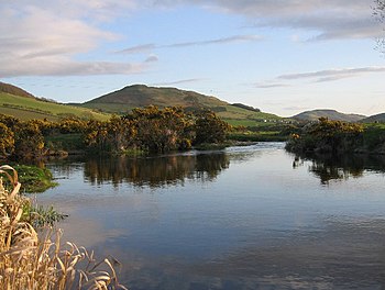
Bowmont Water: Difference between revisions
Created page with "right|thumb|350px|The Bowmont Water forming a pool near Kirk Yetholm {{county|Norrthumberland}} '''Bowmont Water''' rises..." |
mNo edit summary |
||
| (One intermediate revision by one other user not shown) | |||
| Line 1: | Line 1: | ||
[[File:Bowmont Water - geograph.org.uk - 162381.jpg|right|thumb|350px|The Bowmont Water forming a pool near Kirk Yetholm]] | [[File:Bowmont Water - geograph.org.uk - 162381.jpg|right|thumb|350px|The Bowmont Water forming a pool near Kirk Yetholm]] | ||
{{county| | {{county|Northumberland}} | ||
'''Bowmont Water''' rises in a series of streams off the slopes of [[Cock Law]] in the [[Cheviot Hills]]; the Kingsseat Burn, the Kelsocleugh Burn and the Back Burn principally, all rising of the [[Roxburghshire]] side of the watershed formed by the long ridge of [[Windy Gyle]] and [[king's Seat]] which carries the [[Pennine Way]] and marks the boundary of [[Northumberland]] to the south. The streams unite at {{map|NT852186|Cocklawfoot}} to become the Bowmont Water. | '''Bowmont Water''' rises in a series of streams off the slopes of [[Cock Law]] in the [[Cheviot Hills]]; the Kingsseat Burn, the Kelsocleugh Burn and the Back Burn principally, all rising of the [[Roxburghshire]] side of the watershed formed by the long ridge of [[Windy Gyle]] and [[king's Seat]] which carries the [[Pennine Way]] and marks the boundary of [[Northumberland]] to the south. The streams unite at {{map|NT852186|Cocklawfoot}} to become the Bowmont Water. | ||
| Line 8: | Line 8: | ||
==Outside links== | ==Outside links== | ||
{{commons}} | |||
*Location map: {{wmap|55.571|-02.149|zoom=12}} | *Location map: {{wmap|55.571|-02.149|zoom=12}} | ||
*Streetmap:{{map|NT907308}} | *Streetmap:{{map|NT907308}} | ||
Latest revision as of 10:12, 17 May 2015

Bowmont Water rises in a series of streams off the slopes of Cock Law in the Cheviot Hills; the Kingsseat Burn, the Kelsocleugh Burn and the Back Burn principally, all rising of the Roxburghshire side of the watershed formed by the long ridge of Windy Gyle and king's Seat which carries the Pennine Way and marks the boundary of Northumberland to the south. The streams unite at Cocklawfoot to become the Bowmont Water.
The Bowmont flows northwest then northwards through Roxburghshire, passing famrs and hamlets but no substantial village until it passes between Town Yetholm and Kirk Yetholm. Here it turns northeast and by Yetholm Mains and Shotton it enters Northumberland.
In Northumberland the Bowmont Water continues past Mindrum Mill and Mindrum Station where it turns eastward, to Thornington, and finally to Lanton Mill where it joins College Burn to form the River Glen.
Outside links
| ("Wikimedia Commons" has material about Bowmont Water) |
- Location map: 55°34’16"N, 2°8’56"W
- Streetmap:NT907308
- Local Cycling Trails - Kelso
- Geograph File: Bowmont Water and Westnewton Burn
- Geograph File: Bowmont Water near Pawston
References
- Mercer and Tipping, R {J} and R (1988), 'Bowmont Valley, Roxburghshire', Univ Edinburgh Dept Archaeol Annu Rep, vol.34 Page 23, No.9.7
