Swatte Fell: Difference between revisions
Jump to navigation
Jump to search
Created page with "{{Infobox hill |name=Swatte Fell |county=Dumfriesshire |range=Moffat Hills |picture=Wall, Swatte Fell - geograph.org.uk - 386059.jpg |picture caption=On Swatte Fell |height=2..." |
Undo revision 85590 by Custompackagingboxes (talk) |
| (One intermediate revision by one other user not shown) | |
(No difference)
| |
Latest revision as of 21:56, 23 October 2023
| Swatte Fell | |||
| Dumfriesshire | |||
|---|---|---|---|
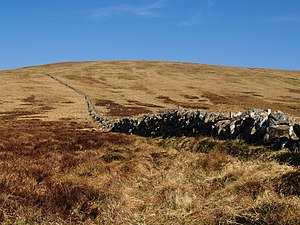
 On Swatte Fell | |||
| Range: | Moffat Hills | ||
| Summit: | 2,389 feet NT117114 55°23’21"N, 3°23’44"W | ||
Swatte Fell is a mountain amongst the Moffat Hills in northern Dumfriesshire. It is just to the south of the higher Hart Fell.
The Coomb Craigs are to the east, crags separating the fell from the valley of the Blackhope Burn.