Difference between revisions of "Tagoat"
From Wikishire
(Created page with "{{Infobox town |name=Tagoat |irish=Teach Gót |county=Wexford |picture caption=Tagoat |picture=Tagoat village - geograph.org.uk - 1370026.jpg |os grid ref=T101114 |latitude=52...") |
(No difference)
|
Latest revision as of 21:24, 19 June 2024
| Tagoat Irish: Teach Gót | |
| County Wexford | |
|---|---|
 Tagoat | |
| Location | |
| Grid reference: | T101114 |
| Location: | 52°14’38"N, 6°23’20"W |
| Data | |
| Local Government | |
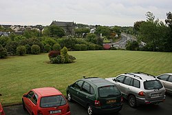
Tagoat is a village in County Wexford, on the N25 and R736 roads, to the west of Rosslare Harbour, in the Barony of Forth.[1]
The village has a Roman Catholic church and a Gaelic Athletic Association team.
References
- ↑ "Tagoat". Topographical Dictionary of Ireland. Samuel Lewis. 1837. https://www.libraryireland.com/topog/T/Tagoat-Forth-Wexford.php.
- Teach Gót / Tagoat: Placenames Database of Ireland