Difference between revisions of "Bevercotes"
From Wikishire
(Created page with "{{Infobox town |name=Bevercotes |county=Nottinghamshire |picture=Lound Hall, Bevercotes, Nottinghamshire - geograph.org.uk - 168173.jpg |picture caption=Lound Hall, Bevercotes...") |
(No difference)
|
Latest revision as of 20:43, 14 August 2021
| Bevercotes | |
| Nottinghamshire | |
|---|---|
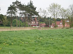
 Lound Hall, Bevercotes | |
| Location | |
| Grid reference: | SK698725 |
| Location: | 53°14’42"N, 0°57’11"W |
| Data | |
| Population: | 28 |
| Post town: | Newark |
| Postcode: | NG22 |
| Dialling code: | 01623 |
| Local Government | |
| Council: | Bassetlaw |
| Parliamentary constituency: |
Newark |
Bevercotes is a hamlet in Nottinghamshire, about six miles south of East Retford and five miles north-east of Ollerton. The 2001 census recorded a population of 28.
The former Bevercotes Colliery was one of the first fully automated coal mines in the country.[1]
Outside links
| ("Wikimedia Commons" has material about Bevercotes) |
References
- ↑ Sandeman, Kit (24 August 2019). "What happened to the Nottinghamshire coal mines?". Nottingham Post. https://www.nottinghampost.com/news/local-news/what-happened-nottinghamshire-coal-mines-3247167.