Template:FP-Dunstable Downs: Difference between revisions
Jump to navigation
Jump to search
Created page with "{{#switch:{{{1}}} |pic=Dunstable Downs. - geograph.org.uk - 1238996.jpg |cap=On the crest of the Dunstable Downs |text=The '''Dunstable Downs''' in southern Bedfordshire f..." |
No edit summary |
||
| (One intermediate revision by the same user not shown) | |||
| Line 4: | Line 4: | ||
|text=The '''Dunstable Downs''' in southern [[Bedfordshire]] form a chalk escarpment which marks the north-eastern reaches of the Chiltern Hills. | |text=The '''Dunstable Downs''' in southern [[Bedfordshire]] form a chalk escarpment which marks the north-eastern reaches of the Chiltern Hills. | ||
The heighest point of the Dunstable Downs reaches 797 feet and is the highest point of Bedfordshire. It lies close to the county tops of Hertfordshire and Buckinghamshire also, at Pavis Wood and Haddington Hill respectively. The Downs are owned by the National Trust}}<noinclude> | The heighest point of the Dunstable Downs reaches 797 feet and is the highest point of Bedfordshire. It lies close to the county tops of Hertfordshire and Buckinghamshire also, at Pavis Wood and Haddington Hill respectively. The Downs are owned by the National Trust.}}<noinclude>{{FP data}} | ||
Latest revision as of 18:53, 6 May 2021
 |
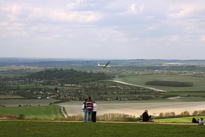
Dunstable DownsThe Dunstable Downs in southern Bedfordshire form a chalk escarpment which marks the north-eastern reaches of the Chiltern Hills. The heighest point of the Dunstable Downs reaches 797 feet and is the highest point of Bedfordshire. It lies close to the county tops of Hertfordshire and Buckinghamshire also, at Pavis Wood and Haddington Hill respectively. The Downs are owned by the National Trust. (Read more) |