Holme Marsh: Difference between revisions
Jump to navigation
Jump to search
Created page with "{{Infobox town |name=Holme Marsh |county=Herefordshire |picture=Holme Marsh, Herefordshire - geograph-3854944.jpg |picture caption=Holme Marsh |os grid ref=SO340547 |latitude=..." |
No edit summary |
||
| Line 19: | Line 19: | ||
The village is on the A480 road, as is Lyonshall, and close to the border of [[Radnorshire]] to the west. | The village is on the A480 road, as is Lyonshall, and close to the border of [[Radnorshire]] to the west. | ||
On the west edge of the village is a short, still visible section of [[Offa's Dyke]]. | |||
Latest revision as of 09:37, 24 August 2019
| Holme Marsh | |
| Herefordshire | |
|---|---|
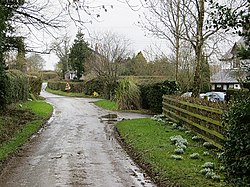
 Holme Marsh | |
| Location | |
| Grid reference: | SO340547 |
| Location: | 52°11’13"N, 2°57’58"W |
| Data | |
| Postcode: | HR5 |
| Local Government | |
| Council: | Herefordshire |
Holme Marsh is a village in Herefordshire, immediately south of Lyonshall. The nearest town is a small one; Kington.
The village is on the A480 road, as is Lyonshall, and close to the border of Radnorshire to the west.
On the west edge of the village is a short, still visible section of Offa's Dyke.