Difference between revisions of "Ugborough"
(Created page with "{{Infobox town |name=Ugborough |county=Devon |picture=Ugborough, St Peter's church and village - geograph.org.uk - 480266.jpg |picture caption=Ugborough |os grid ref=SX677557...") |
|||
| (One intermediate revision by the same user not shown) | |||
| Line 23: | Line 23: | ||
The parish includes a number of settlements other than the village such as Bittaford, Wrangaton (which once had a railway station), Cheston and Moorhaven Village<ref>[http://www.ugboroughparishcouncil.gov.uk/ Ugborough Parish Council]</ref><ref>[http://www.moorhaven.org.uk/ Moorhaven Village]</ref> | The parish includes a number of settlements other than the village such as Bittaford, Wrangaton (which once had a railway station), Cheston and Moorhaven Village<ref>[http://www.ugboroughparishcouncil.gov.uk/ Ugborough Parish Council]</ref><ref>[http://www.moorhaven.org.uk/ Moorhaven Village]</ref> | ||
| − | To the southeast of Ugborough, within the parish, | + | To the southeast of Ugborough, within the parish, are the ruins of [[Fowelscombe House]]. |
==Society== | ==Society== | ||
| Line 38: | Line 38: | ||
==References== | ==References== | ||
| − | {{Reflist} | + | {{Reflist}} |
Latest revision as of 19:36, 26 December 2018
| Ugborough | |
| Devon | |
|---|---|
 Ugborough | |
| Location | |
| Grid reference: | SX677557 |
| Location: | 50°23’10"N, 3°51’38"W |
| Data | |
| Population: | 1,736 (2001, parish) |
| Post town: | Ivybridge |
| Postcode: | PL21 |
| Dialling code: | 01752 |
| Local Government | |
| Council: | South Hams |
| Parliamentary constituency: |
South West Devon |
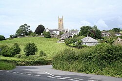
Ugborough is a village in the south of Devon. It has a large church with a history going back to 1121. The parish population was recorded as 1,736 in 2001.
Ugborough is two miles from the A38 ‘Devon Expressway. Ivybridge railway station is found in Ugborough: it was reopened in 1994 to serve Ivybridge and the surrounding villages.
Unusually for a small Devon village, Ugborough has a sizable central square, and the main bulk of the village is set around the square
The parish includes a number of settlements other than the village such as Bittaford, Wrangaton (which once had a railway station), Cheston and Moorhaven Village[1][2]
To the southeast of Ugborough, within the parish, are the ruins of Fowelscombe House.
Society
The village holds a fair every year in July, with traditional games and stalls.
There is a village hall, hosting local events. It doubles as a pre-school, various entertainments are held mainly in the summer months ranging from live music to themed evenings.
More recently a Youth Group has been set up, catering for many of the village's children.
Outside links
| ("Wikimedia Commons" has material about Ugborough) |
- A brief history of the village - Ugborough.com
- Ugborough and Bittaford Pre-school