Millfire: Difference between revisions
Jump to navigation
Jump to search
Created page with "Millfire {{Infobox hill |name=Millfire |county=Kirkcudbrightshire |range=Rhinns of Kells |picture=Summit cairn on Millfire - geograph.org.uk - 1540201.jpg |height=2,350 feet ..." |
No edit summary |
||
| (One intermediate revision by the same user not shown) | |||
| Line 1: | Line 1: | ||
{{Infobox hill | {{Infobox hill | ||
|name=Millfire | |name=Millfire | ||
|county=Kirkcudbrightshire | |county=Kirkcudbrightshire | ||
|range=Rhinns of Kells | |range=Rhinns of Kells | ||
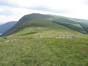
|picture= | |picture=Rhinns of Kells ridge towards Millfire - geograph.org.uk - 207497.jpg | ||
|height=2,350 feet | |height=2,350 feet | ||
|latitude=55.134704 | |latitude=55.134704 | ||
Latest revision as of 23:20, 1 March 2018
| Millfire | |||
| Kirkcudbrightshire | |||
|---|---|---|---|

| |||
| Range: | Rhinns of Kells | ||
| Summit: | 2,350 feet NX507847 55°8’5"N, 4°20’32"W | ||
Millfire is a mountain of 2,350 feet which is part of the ridge of the Rhinns of Kells in Kirkcudbrightshire.
Millfire is found in the midst of the Rhinns, south of its highest hill, Corserine.