Difference between revisions of "Gilston, East Lothian"
From Wikishire
(Created page with "{{Infobox town |name=Gilston |county=East Lothian |picture=Gilston - geograph.org.uk - 35875.jpg |picture caption= |os grid ref=NT443561 |latitude=55.795557 |longitude=-2.8894...") |
(No difference)
|
Latest revision as of 23:57, 18 November 2016
| Gilston | |
| East Lothian | |
|---|---|

| |
| Location | |
| Grid reference: | NT443561 |
| Location: | 55°47’44"N, 2°53’22"W |
| Data | |
| Post town: | EH38 |
| Local Government | |
| Council: | Scottish Borders |
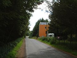
Gilston is a tiny hamlet beside the B6368 road, in the southernmost arm of East Lothian. The road here runs up from Soutra Hill on the main A68 Road and down a little dale to the valley of the Gala Water.
This East Lothian article is a stub: help to improve Wikishire by building it up.