Difference between revisions of "Loth"
From Wikishire
(Created page with "{{county|Sutherland}} Beach near Lothbeg Point '''Loth''' is a parish on the east coast of Sutherland...") |
|||
| Line 1: | Line 1: | ||
{{county|Sutherland}} | {{county|Sutherland}} | ||
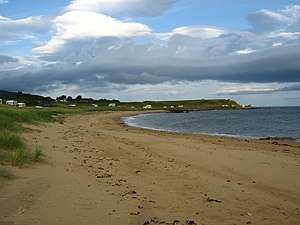
[[File:Beach near Lothbeg Point - geograph.org.uk - 1513908.jpg|thumb|Beach near Lothbeg Point]] | [[File:Beach near Lothbeg Point - geograph.org.uk - 1513908.jpg|thumb|Beach near Lothbeg Point]] | ||
| − | '''Loth''' is a parish on the east coast of [[Sutherland]], situated between [[Clyne]] to the south and [[Kildonan]] to the north. The A9 trunk road and railway hug the coast between [[Brora]] to the south and [[Helmsdale]] to the north, both of which have stations, the station at Loth having closed in October 1963. The parish contains the hamlets of Lothbeg, Lothmore, Kilmote and Portgower, with a total population of 112. The surface for the most part is hilly, and attains in some parts a height of 1,500 feet above sea level. There are several streamlets, the principal being the Loth. | + | '''Loth''' is a parish on the east coast of [[Sutherland]], situated between [[Clyne]] to the south and [[Kildonan, Sutherland|Kildonan]] to the north. The A9 trunk road and railway hug the coast between [[Brora]] to the south and [[Helmsdale]] to the north, both of which have stations, the station at Loth having closed in October 1963. The parish contains the hamlets of Lothbeg, Lothmore, Kilmote and Portgower, with a total population of 112. The surface for the most part is hilly, and attains in some parts a height of 1,500 feet above sea level. There are several streamlets, the principal being the Loth. |
There are remains of Picts' houses on Loth Water, also cairns, tumuli, and a pillar of stone 10 feet high. The last witch burnt in Scotland suffered here about 1720.<ref>National Gazetteer of Great Britain and Ireland, 1868</ref> | There are remains of Picts' houses on Loth Water, also cairns, tumuli, and a pillar of stone 10 feet high. The last witch burnt in Scotland suffered here about 1720.<ref>National Gazetteer of Great Britain and Ireland, 1868</ref> | ||
==References== | ==References== | ||
| + | *Location map: {{wmap|58.089|-3.803|zoom=13}} | ||
{{reflist}} | {{reflist}} | ||
[[Category:Towns and villages in Sutherland]] | [[Category:Towns and villages in Sutherland]] | ||
{{stub}} | {{stub}} | ||
Latest revision as of 08:18, 18 April 2016
Loth is a parish on the east coast of Sutherland, situated between Clyne to the south and Kildonan to the north. The A9 trunk road and railway hug the coast between Brora to the south and Helmsdale to the north, both of which have stations, the station at Loth having closed in October 1963. The parish contains the hamlets of Lothbeg, Lothmore, Kilmote and Portgower, with a total population of 112. The surface for the most part is hilly, and attains in some parts a height of 1,500 feet above sea level. There are several streamlets, the principal being the Loth.
There are remains of Picts' houses on Loth Water, also cairns, tumuli, and a pillar of stone 10 feet high. The last witch burnt in Scotland suffered here about 1720.[1]
References
- Location map: 58°5’20"N, 3°48’11"W
- ↑ National Gazetteer of Great Britain and Ireland, 1868
