Stockbridge Down
| Stockbridge Down | |
| Hampshire | |
|---|---|

| |
| Summit: | 518 feet SU379349 51.115226, -1.456786 |
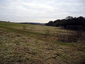
Stockbridge Down is a gentle hill in Hampshire, in the middle of the county, on the eats side of the braided streams of the River Test, The down is to the east of Stockbridge. Its summit climbs to 518 feet and is surrounded by the earthworks of an Iron Agee hill fort, Woolbury, or 'Woolbury Ring'.
On the south slope of the downs, 172½ acres have been designated a biological Site of Special Scientific Interest.[1] This area is also a Nature Conservation Review site, Grade 2.[2]
Much of the hill is owned by the National Trust and the fort and surrounding sites are together a Scheduled Monument, including the hillfort and fourteen Bronze Age burial mounds.[3][4]
This site has a variety of scrub and grassland habitats on a north-west facing slope of chalk and a clay-with-flints plateau. There is a diverse range of butterflies, such as chalk-hill blue, |marbled white (Melanargia galathea) and dark green fritillary, while moths include the oblique striped moth.[1]
| ("Wikimedia Commons" has material about Stockbridge Down) |
References
- ↑ 1.0 1.1 SSSI listing and designation for Stockbridge Down
- ↑ Ratcliffe, Derek, ed (1977). A Nature Conservation Review. 2. Cambridge, UK: Cambridge University Press. p. 130. ISBN 0521 21403 3.
- ↑ Stockbridge Down: National Trust
- ↑ National Heritage List 1003531: Woolbury Ring